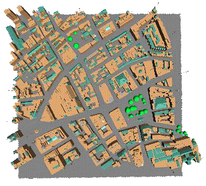
The entire area is modelled in 3D with each building's form accurately represented. As well as showing what happens above ground, underground features are included. It is possible to make links between objects in the model and data held on the Internet using the World Wide Web.
These maps provide a tool for analysing the relationships between built form and various kinds of data. In the future they will offer a publicly accessible interface to a wide reange of urban information.
Thanks to BT Labs and EPSRC for the financial support of the model's construction.